
 DE
 English
 Italiano
 Español
 Français
 Nederlands
 Português
 Slovenščina
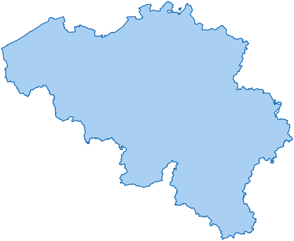
 Belgien Verwaltungsgrenzen
3 Regionen, 11 Provinzen und 565 Gemeinden, jeweils mit amtlichem Code, in GeoJSON, TopoJSON, GeoPackage, Shapefile, SVG mit Layern, CSV und SQL.
- Regionen
- 3
- Provinzen
- 11
- Gemeinden
- 565
- Ausgabe
Eines der Beispiele im Paket
Ein SVG mit Layern, mit wenigen Zeilen reinem JavaScript aus einer Tabelle eingefärbt: Jede Einheit ist ein Pfad, dessen id ihr amtlicher Code ist. Die Seite zeigt einen Teil des Landes: Die beiden Ebenen haben dieselben Grenzen und passen daher lückenlos zusammen. Das Paket enthält jede Einheit jeder Ebene.
Flandern: die Gemeinden der Provinz Antwerpen, nach Fläche eingefärbt, zwischen den anderen Provinzen.
Was das Paket enthält
Ebenen und Identifikatoren
| Ebene | Einheiten | Identifikator |
|---|---|---|
| Staat | 1 | BE |
| Regionen | 3 | BE-R-<amtlicher Code> |
| Provinzen | 11 | BE-P-<amtlicher Code> |
| Gemeinden | 565 | BE-M-<amtlicher Code> |
Jede Einheit hat in jeder Datei denselben Identifikator: Er ist die id des Features in GeoJSON und TopoJSON, die id des Pfads im SVG und die Spalte id der Tabellen.
Formate und Maßstäbe
| Format | full | 100m | 1km | 10km | light |
|---|---|---|---|---|---|
| GeoJSON | 31,2 MB | 1,6 MB | 342 KB | 9 KB | 771 KB |
| TopoJSON | 5,2 MB | 481 KB | 209 KB | 5 KB | 504 KB |
| Shapefile | 27,0 MB | 1,3 MB | 271 KB | 8 KB | 658 KB |
| SVG | - | 1,7 MB | 339 KB | 10 KB | 861 KB |
full: die Grenzen, wie die Quelle sie veröffentlicht.100m: auf 100 m genau vereinfacht und konsistent: Gemeinden, Provinzen und Regionen haben exakt dieselben Stützpunkte an der Grenze.1km: auf 1 km genau vereinfacht und konsistent wie100m, alle Ebenen: das ganze Land auf einer Webkarte.10km: auf 10 km genau vereinfacht und konsistent, nur Staat, Regionen und Provinzen: kleine Karten und Karten mehrerer Länder.- An den Grenzen zu den Nachbarländern (Deutschland, Frankreich, Luxemburg und Niederlande) haben die Grenzen
100m,1kmund10kmdieselben Punkte wie in deren Paketen, sodass die Karten ohne Lücken oder Überlappungen zusammenpassen. light: nur Staat, Regionen und Provinzen, jede Ebene für sich zu einer kleinen Datei vereinfacht.- GeoJSON: eine FeatureCollection je Ebene, WGS84. TopoJSON: alle Ebenen in einer Topologie, gemeinsame Grenzen sind gemeinsame Arcs.
- GeoPackage:
data/geopackage/be.gpkg(30,8 MB), eine Datei für QGIS und ArcGIS mit jeder Ebene in jedem Maßstab als Layer (municipalities_100m) samt räumlichem Index sowie allen Tabellen des Pakets. - Shapefile: eine Datei je Ebene und Maßstab, WGS84, UTF-8; Spaltennamen mit mehr als zehn Zeichen werden gekürzt (
region,province,abbrev). - SVG: eine Datei je Ebene und eine mit allen Ebenen als Layer, in einer winkeltreuen Lambert-Kegelprojektion; sie öffnen sich als Layer in Illustrator, Figma und Inkscape.
- SQL: ein Skript für PostGIS, eines für MySQL 8 und eines für SQL Server (je 1,6 MB). Es legt eine Tabelle mit jeder Einheit jeder Ebene an, mit ihrer
100m-Grenze in WGS84 und ihren Indizes. - JSON:
data/json/tree.json(43 KB), die Ebenen verschachtelt und nach Namen sortiert, ohne Grenzen: was die Auswahllisten eines Formulars brauchen.
Tabellen
CSV, UTF-8. Namen in den Sprachen EN, IT, ES, FR, DE, NL, PT neben dem amtlichen Namen.
| Datei | Zeilen | Inhalt |
|---|---|---|
tables/country.csv |
1 |
Der Staat: Namen, Bevölkerung, Bounding Box, Mittelpunkt und Beschriftungspunkt.
code, name, population, min_lat, min_lng, max_lat, max_lng, center_lat, center_lng, label_lat, label_lng, id, name_en, name_it, name_es, name_fr, name_de, name_nl, name_pt
|
tables/regions.csv |
3 |
Regionen: amtlicher Code, Namen, Fläche, Bevölkerung, Bounding Box, Mittelpunkt und Beschriftungspunkt.
code, name, area_km2, population, min_lat, min_lng, max_lat, max_lng, center_lat, center_lng, label_lat, label_lng, id, name_en, name_it, name_es, name_fr, name_de, name_nl, name_pt
|
tables/provinces.csv |
11 |
Provinzen: amtlicher Code, Kürzel, Code der übergeordneten Einheit, Namen, Fläche, Bevölkerung, Bounding Box, Mittelpunkt und Beschriftungspunkt.
code, name, abbreviation, region_code, area_km2, population, min_lat, min_lng, max_lat, max_lng, center_lat, center_lng, label_lat, label_lng, id, name_en, name_it, name_es, name_fr, name_de, name_nl, name_pt
|
tables/municipalities.csv |
565 |
Gemeinden: amtlicher Code, Codes der übergeordneten Einheiten, Namen, Fläche, Bevölkerung, Höhe in Metern (des Mittelpunkts oder als tiefster und höchster Punkt, je nach Angabe der amtlichen Quelle), Bounding Box, Mittelpunkt und Beschriftungspunkt.
code, name, province_code, province_abbreviation, region_code, cadastral_code, chief_town, area_km2, population, elevation, elevation_min, elevation_max, elevation_mean, min_lat, min_lng, max_lat, max_lng, center_lat, center_lng, label_lat, label_lng, id, name_en, name_it, name_es, name_fr, name_de, name_nl, name_pt
|
tables/names.csv |
582 |
Jeder Name, unter dem eine Einheit geschrieben wird (amtlich, jeder Teil eines zweisprachigen Namens, übersetzt), ohne diakritische Zeichen und als Slug: um eine Datei mit Namen und ohne Codes zuzuordnen.
id, level, name, name_ascii, slug, kind
|
tables/neighbours.csv |
3.232 |
Die Einheiten derselben Ebene mit gemeinsamer Grenze, in beide Richtungen, mit der Länge der gemeinsamen Grenze in km.
level, id, neighbour_id, shared_border_km
|
tables/history.csv |
0 |
Gemeinden, die aufgelöst wurden, mit der Einheit, die sie ersetzt hat, für Archive, die noch die alten Codes enthalten; keine Zeilen, wo die amtliche Quelle keine Historie angibt.
code, name, province_code, replaced_by_code, replaced_by_name
|
tables/changes.csv |
0 |
Was sich von einer Ausgabe des Pakets zur nächsten geändert hat, eine Zeile je Einheit, die hinzugefügt, entfernt, umbenannt oder verschoben wurde oder eine neue Grenze erhalten hat: dasselbe wie CHANGELOG.md.
edition, date, level, id, name, change, before, after
|
Quellen und Lizenzen
Das Paket ist ein abgeleitetes Werk der unten genannten amtlichen Datensätze; deren Herausgeber befürworten es nicht. Was Sie damit tun dürfen, steht in der Lizenz der Pakete.
- Nationaal Geografisch Instituut / Institut géographique national (NGI-IGN), AdminVector (Territorial Divisions): regions, provinces, municipalities, municipal sections, lizenziert unter CC BY 4.0
- Nationaal Geografisch Instituut / Institut géographique national (NGI-IGN), AdminVector (Territorial Divisions): regions, provinces, municipalities, municipal sections, lizenziert unter CC BY 4.0
Dateien
Alle 148 Dateien des Pakets mit ihrer Größe.
ATTRIBUTION.md | 2 KB |
|---|---|
CHANGELOG.md | 0 KB |
LICENSE.md | 2 KB |
README.md | 12 KB |
data/geojson/100m/country.geojson | 70 KB |
data/geojson/100m/municipalities.geojson | 1,2 MB |
data/geojson/100m/provinces.geojson | 218 KB |
data/geojson/100m/regions.geojson | 115 KB |
data/geojson/10km/country.geojson | 1 KB |
data/geojson/10km/provinces.geojson | 5 KB |
data/geojson/10km/regions.geojson | 2 KB |
data/geojson/1km/country.geojson | 11 KB |
data/geojson/1km/municipalities.geojson | 281 KB |
data/geojson/1km/provinces.geojson | 33 KB |
data/geojson/1km/regions.geojson | 18 KB |
data/geojson/full/municipalities.geojson | 24,4 MB |
data/geojson/full/provinces.geojson | 4,6 MB |
data/geojson/full/regions.geojson | 2,2 MB |
data/geojson/light/country.geojson | 37 KB |
data/geojson/light/provinces.geojson | 552 KB |
data/geojson/light/regions.geojson | 182 KB |
data/geopackage/be.gpkg | 30,8 MB |
data/json/tree.json | 43 KB |
data/shapefile/100m/country.cpg | 0 KB |
data/shapefile/100m/country.dbf | 0 KB |
data/shapefile/100m/country.prj | 0 KB |
data/shapefile/100m/country.shp | 59 KB |
data/shapefile/100m/country.shx | 0 KB |
data/shapefile/100m/municipalities.cpg | 0 KB |
data/shapefile/100m/municipalities.dbf | 52 KB |
data/shapefile/100m/municipalities.prj | 0 KB |
data/shapefile/100m/municipalities.shp | 973 KB |
data/shapefile/100m/municipalities.shx | 5 KB |
data/shapefile/100m/provinces.cpg | 0 KB |
data/shapefile/100m/provinces.dbf | 1 KB |
data/shapefile/100m/provinces.prj | 0 KB |
data/shapefile/100m/provinces.shp | 184 KB |
data/shapefile/100m/provinces.shx | 0 KB |
data/shapefile/100m/regions.cpg | 0 KB |
data/shapefile/100m/regions.dbf | 0 KB |
data/shapefile/100m/regions.prj | 0 KB |
data/shapefile/100m/regions.shp | 98 KB |
data/shapefile/100m/regions.shx | 0 KB |
data/shapefile/10km/country.cpg | 0 KB |
data/shapefile/10km/country.dbf | 0 KB |
data/shapefile/10km/country.prj | 0 KB |
data/shapefile/10km/country.shp | 1 KB |
data/shapefile/10km/country.shx | 0 KB |
data/shapefile/10km/provinces.cpg | 0 KB |
data/shapefile/10km/provinces.dbf | 1 KB |
data/shapefile/10km/provinces.prj | 0 KB |
data/shapefile/10km/provinces.shp | 3 KB |
data/shapefile/10km/provinces.shx | 0 KB |
data/shapefile/10km/regions.cpg | 0 KB |
data/shapefile/10km/regions.dbf | 0 KB |
data/shapefile/10km/regions.prj | 0 KB |
data/shapefile/10km/regions.shp | 2 KB |
data/shapefile/10km/regions.shx | 0 KB |
data/shapefile/1km/country.cpg | 0 KB |
data/shapefile/1km/country.dbf | 0 KB |
data/shapefile/1km/country.prj | 0 KB |
data/shapefile/1km/country.shp | 9 KB |
data/shapefile/1km/country.shx | 0 KB |
data/shapefile/1km/municipalities.cpg | 0 KB |
data/shapefile/1km/municipalities.dbf | 52 KB |
data/shapefile/1km/municipalities.prj | 0 KB |
data/shapefile/1km/municipalities.shp | 161 KB |
data/shapefile/1km/municipalities.shx | 5 KB |
data/shapefile/1km/provinces.cpg | 0 KB |
data/shapefile/1km/provinces.dbf | 1 KB |
data/shapefile/1km/provinces.prj | 0 KB |
data/shapefile/1km/provinces.shp | 26 KB |
data/shapefile/1km/provinces.shx | 0 KB |
data/shapefile/1km/regions.cpg | 0 KB |
data/shapefile/1km/regions.dbf | 0 KB |
data/shapefile/1km/regions.prj | 0 KB |
data/shapefile/1km/regions.shp | 15 KB |
data/shapefile/1km/regions.shx | 0 KB |
data/shapefile/full/municipalities.cpg | 0 KB |
data/shapefile/full/municipalities.dbf | 52 KB |
data/shapefile/full/municipalities.prj | 0 KB |
data/shapefile/full/municipalities.shp | 21,1 MB |
data/shapefile/full/municipalities.shx | 5 KB |
data/shapefile/full/provinces.cpg | 0 KB |
data/shapefile/full/provinces.dbf | 1 KB |
data/shapefile/full/provinces.prj | 0 KB |
data/shapefile/full/provinces.shp | 3,9 MB |
data/shapefile/full/provinces.shx | 0 KB |
data/shapefile/full/regions.cpg | 0 KB |
data/shapefile/full/regions.dbf | 0 KB |
data/shapefile/full/regions.prj | 0 KB |
data/shapefile/full/regions.shp | 1,9 MB |
data/shapefile/full/regions.shx | 0 KB |
data/shapefile/light/country.cpg | 0 KB |
data/shapefile/light/country.dbf | 0 KB |
data/shapefile/light/country.prj | 0 KB |
data/shapefile/light/country.shp | 31 KB |
data/shapefile/light/country.shx | 0 KB |
data/shapefile/light/provinces.cpg | 0 KB |
data/shapefile/light/provinces.dbf | 1 KB |
data/shapefile/light/provinces.prj | 0 KB |
data/shapefile/light/provinces.shp | 469 KB |
data/shapefile/light/provinces.shx | 0 KB |
data/shapefile/light/regions.cpg | 0 KB |
data/shapefile/light/regions.dbf | 0 KB |
data/shapefile/light/regions.prj | 0 KB |
data/shapefile/light/regions.shp | 154 KB |
data/shapefile/light/regions.shx | 0 KB |
data/topojson/100m/be.topojson | 481 KB |
data/topojson/10km/be.topojson | 5 KB |
data/topojson/1km/be.topojson | 209 KB |
data/topojson/full/be.topojson | 5,2 MB |
data/topojson/light/be.topojson | 504 KB |
examples/choropleth-svg.html | 129 KB |
examples/drill-down-d3.html | 89 KB |
examples/leaflet-geojson.html | 555 KB |
examples/lib/LICENSES.md | 3 KB |
examples/lib/d3.min.js | 273 KB |
examples/lib/leaflet.css | 14 KB |
examples/lib/leaflet.js | 144 KB |
examples/lib/topojson-client.min.js | 7 KB |
examples/point-lookup.html | 227 KB |
flags/BE.svg | 0 KB |
sql/mysql.sql | 1,6 MB |
sql/postgis.sql | 1,6 MB |
sql/sqlserver.sql | 1,6 MB |
svg/100m/layers.svg | 912 KB |
svg/100m/municipalities.svg | 682 KB |
svg/100m/provinces.svg | 124 KB |
svg/100m/regions.svg | 66 KB |
svg/10km/layers.svg | 5 KB |
svg/10km/provinces.svg | 3 KB |
svg/10km/regions.svg | 2 KB |
svg/1km/layers.svg | 172 KB |
svg/1km/municipalities.svg | 137 KB |
svg/1km/provinces.svg | 19 KB |
svg/1km/regions.svg | 10 KB |
svg/light/layers.svg | 441 KB |
svg/light/provinces.svg | 316 KB |
svg/light/regions.svg | 104 KB |
tables/changes.csv | 0 KB |
tables/country.csv | 0 KB |
tables/history.csv | 0 KB |
tables/municipalities.csv | 109 KB |
tables/names.csv | 37 KB |
tables/neighbours.csv | 136 KB |
tables/provinces.csv | 2 KB |
tables/regions.csv | 1 KB |
Das Paket für Belgien ist noch nicht erhältlich. Sie können es schon jetzt testen: Fordern Sie die kostenlose Probe an, Région wallonne (5 Provinzen und 261 Gemeinden) mit denselben Dateien und Formaten.