
 ES
 English
 Italiano
 Français
 Deutsch
 Nederlands
 Português
 Slovenščina
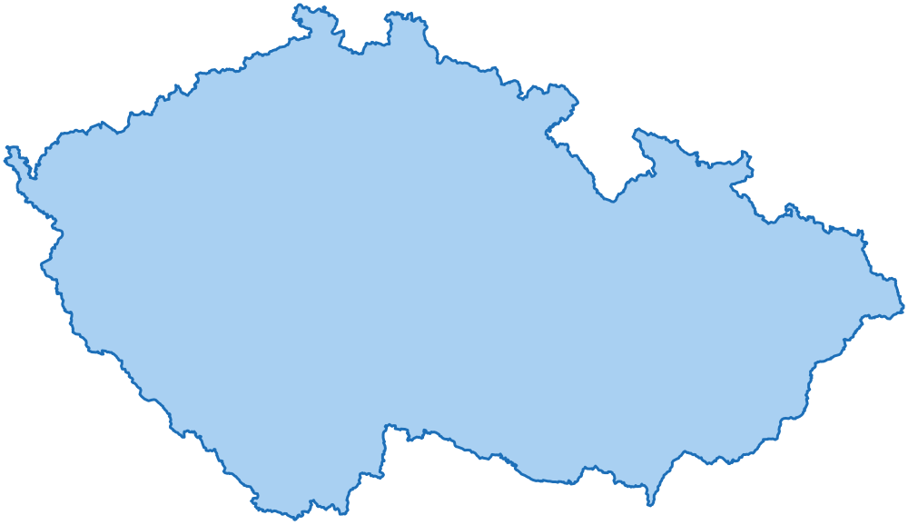
 Chequia límites administrativos
14 regiones, 77 distritos y 6.258 municipios, con su código oficial, en GeoJSON, TopoJSON, GeoPackage, Shapefile, SVG por capas, CSV y SQL.
- regiones
- 14
- distritos
- 77
- municipios
- 6.258
- edición
Uno de los ejemplos del paquete
Un SVG por capas coloreado a partir de una tabla con unas pocas líneas de JavaScript puro: cada entidad es un path cuyo id es su código oficial. La página muestra una parte del país: los dos niveles comparten los mismos límites, así que encajan sin huecos. El paquete contiene todas las entidades de todos los niveles.
Moravia Meridional: los municipios del distrito de Brno-venkov, coloreados por superficie, entre los demás distritos.
Qué contiene el paquete
Niveles e identificadores
| Nivel | Entidades | Identificador |
|---|---|---|
| país | 1 | CZ |
| regiones | 14 | CZ-R-<código oficial> |
| distritos | 77 | CZ-P-<código oficial> |
| municipios | 6.258 | CZ-M-<código oficial> |
Cada entidad tiene el mismo identificador en todos los archivos: es el id de la feature en GeoJSON y TopoJSON, el id del path en SVG y la columna id de las tablas.
Formatos y escalas
| Formato | full | 100m | 1km | 10km | light |
|---|---|---|---|---|---|
| GeoJSON | 122,2 MB | 9,8 MB | 2,7 MB | 40 KB | 828 KB |
| TopoJSON | 21,4 MB | 3,5 MB | 2,0 MB | 27 KB | 353 KB |
| Shapefile | 99,1 MB | 7,8 MB | 2,1 MB | 30 KB | 668 KB |
| SVG | - | 10,1 MB | 2,5 MB | 39 KB | 875 KB |
full: los límites tal como los publica la fuente.100m: simplificación a 100 m, coherente entre niveles (municipios, distritos y regiones): comparten exactamente los mismos vértices del límite.1km: simplificación a 1 km, coherente como100m, en todos los niveles: el país entero en un mapa web.10km: simplificación a 10 km, coherente, solo para estos niveles (país, regiones y distritos): mapas pequeños y mapas de muchos países.- En las fronteras con los países vecinos (Alemania, Austria, Eslovaquia y Polonia), los límites
100m,1kmy10kmtienen los mismos vértices que en sus paquetes, así que los mapas encajan sin huecos ni solapamientos. light: solo para estos niveles (país, regiones y distritos), cada uno simplificado por separado en un archivo pequeño.- GeoJSON: una FeatureCollection por nivel, WGS84. TopoJSON: todos los niveles en una sola topología; los límites compartidos son arcos compartidos.
- GeoPackage:
data/geopackage/cz.gpkg(120,6 MB), un solo archivo para QGIS y ArcGIS con cada nivel en cada escala como capa (municipalities_100m) con su índice espacial, y todas las tablas del paquete. - Shapefile: uno por nivel y escala, WGS84, UTF-8; las columnas de más de diez caracteres se acortan (
region,province,abbrev). - SVG: un archivo por nivel y otro con todos los niveles como capas, en proyección cónica conforme de Lambert; se abren como capas en Illustrator, Figma e Inkscape.
- SQL: un script para PostGIS, otro para MySQL 8 y otro para SQL Server (9,9 MB cada uno). Crea una sola tabla con todas las entidades de todos los niveles, su límite
100men WGS84 y sus índices. - JSON:
data/json/tree.json(497 KB), los niveles anidados y ordenados por nombre, sin límites: lo que necesitan los desplegables de un formulario.
Tablas
CSV, UTF-8. Nombres en EN, IT, ES, FR, DE, NL, PT, además del oficial.
| Archivo | Filas | Contenido |
|---|---|---|
tables/country.csv |
1 |
El país: nombres, población, bounding box, centro y punto de la etiqueta.
code, name, population, min_lat, min_lng, max_lat, max_lng, center_lat, center_lng, label_lat, label_lng, id, name_en, name_it, name_es, name_fr, name_de, name_nl, name_pt
|
tables/regions.csv |
14 |
Una fila por entidad (regiones): código oficial, nombres, superficie, población, bounding box, centro y punto de la etiqueta.
code, name, area_km2, population, min_lat, min_lng, max_lat, max_lng, center_lat, center_lng, label_lat, label_lng, id, name_en, name_it, name_es, name_fr, name_de, name_nl, name_pt
|
tables/provinces.csv |
77 |
Una fila por entidad (distritos): código oficial, sigla, código de la entidad superior, nombres, superficie, población, bounding box, centro y punto de la etiqueta.
code, name, abbreviation, region_code, area_km2, population, min_lat, min_lng, max_lat, max_lng, center_lat, center_lng, label_lat, label_lng, id, name_en, name_it, name_es, name_fr, name_de, name_nl, name_pt
|
tables/municipalities.csv |
6.258 |
Una fila por entidad (municipios): código oficial, códigos de las entidades superiores, nombres, superficie, población, altitud en metros (del centro, o mínima y máxima, según la fuente oficial), bounding box, centro y punto de la etiqueta.
code, name, province_code, province_abbreviation, region_code, cadastral_code, chief_town, area_km2, population, elevation, elevation_min, elevation_max, elevation_mean, min_lat, min_lng, max_lat, max_lng, center_lat, center_lng, label_lat, label_lng, id, name_en, name_it, name_es, name_fr, name_de, name_nl, name_pt
|
tables/codes.csv |
6.350 |
Cada entidad en otros conjuntos de datos, según la declara Wikidata: el elemento de Wikidata, ISO 3166-2, GeoNames y la relación de OpenStreetMap.
id, level, code, wikidata, iso_3166_2, geonames, osm_relation
|
tables/names.csv |
7.413 |
Todos los nombres con los que se escribe una entidad (oficial, cada parte de un nombre bilingüe, traducido), sin tildes y como slug: para cruzar un archivo que tiene nombres y no códigos.
id, level, name, name_ascii, slug, kind
|
tables/neighbours.csv |
37.452 |
Las entidades del mismo nivel que comparten límite, en ambos sentidos, con la longitud del límite común en km.
level, id, neighbour_id, shared_border_km
|
tables/history.csv |
0 |
Supresiones de municipios, cada una con la entidad que la sustituyó, para archivos que aún tienen los códigos antiguos; sin filas donde la fuente oficial no ofrece historial.
code, name, province_code, replaced_by_code, replaced_by_name
|
tables/changes.csv |
0 |
Lo que cambia de una edición del paquete a la siguiente, una fila por cada entidad añadida, eliminada, renombrada, trasladada o con un límite nuevo: lo mismo que CHANGELOG.md.
edition, date, level, id, name, change, before, after
|
Fuentes y licencias
El paquete es una obra derivada de los conjuntos de datos oficiales que se indican a continuación; sus editores no lo avalan. Lo que puede hacer con él se describe en la licencia de los paquetes.
- Český úřad zeměměřický a katastrální (ČÚZK), Registr územní identifikace, adres a nemovitostí (RÚIAN), územní prvky ve formátu SHP; Počet obyvatel (ČSÚ, OBY02A), con licencia CC BY 4.0
- Český úřad zeměměřický a katastrální (ČÚZK), Registr územní identifikace, adres a nemovitostí (RÚIAN), územní prvky ve formátu SHP, con licencia CC BY 4.0
- Wikidata, Labels and external identifiers of the administrative entities (translated names, codes in other datasets), con licencia CC0 1.0
Archivos
Los 149 archivos del paquete, con su tamaño.
ATTRIBUTION.md | 2 KB |
|---|---|
CHANGELOG.md | 0 KB |
LICENSE.md | 2 KB |
README.md | 12 KB |
data/geojson/100m/country.geojson | 111 KB |
data/geojson/100m/municipalities.geojson | 8,2 MB |
data/geojson/100m/provinces.geojson | 1,1 MB |
data/geojson/100m/regions.geojson | 468 KB |
data/geojson/10km/country.geojson | 2 KB |
data/geojson/10km/provinces.geojson | 29 KB |
data/geojson/10km/regions.geojson | 8 KB |
data/geojson/1km/country.geojson | 18 KB |
data/geojson/1km/municipalities.geojson | 2,4 MB |
data/geojson/1km/provinces.geojson | 173 KB |
data/geojson/1km/regions.geojson | 71 KB |
data/geojson/full/municipalities.geojson | 99,2 MB |
data/geojson/full/provinces.geojson | 15,6 MB |
data/geojson/full/regions.geojson | 7,4 MB |
data/geojson/light/country.geojson | 39 KB |
data/geojson/light/provinces.geojson | 594 KB |
data/geojson/light/regions.geojson | 195 KB |
data/geopackage/cz.gpkg | 120,6 MB |
data/json/tree.json | 497 KB |
data/shapefile/100m/country.cpg | 0 KB |
data/shapefile/100m/country.dbf | 0 KB |
data/shapefile/100m/country.prj | 0 KB |
data/shapefile/100m/country.shp | 90 KB |
data/shapefile/100m/country.shx | 0 KB |
data/shapefile/100m/municipalities.cpg | 0 KB |
data/shapefile/100m/municipalities.dbf | 679 KB |
data/shapefile/100m/municipalities.prj | 0 KB |
data/shapefile/100m/municipalities.shp | 5,8 MB |
data/shapefile/100m/municipalities.shx | 49 KB |
data/shapefile/100m/provinces.cpg | 0 KB |
data/shapefile/100m/provinces.dbf | 5 KB |
data/shapefile/100m/provinces.prj | 0 KB |
data/shapefile/100m/provinces.shp | 864 KB |
data/shapefile/100m/provinces.shx | 1 KB |
data/shapefile/100m/regions.cpg | 0 KB |
data/shapefile/100m/regions.dbf | 1 KB |
data/shapefile/100m/regions.prj | 0 KB |
data/shapefile/100m/regions.shp | 378 KB |
data/shapefile/100m/regions.shx | 0 KB |
data/shapefile/10km/country.cpg | 0 KB |
data/shapefile/10km/country.dbf | 0 KB |
data/shapefile/10km/country.prj | 0 KB |
data/shapefile/10km/country.shp | 2 KB |
data/shapefile/10km/country.shx | 0 KB |
data/shapefile/10km/provinces.cpg | 0 KB |
data/shapefile/10km/provinces.dbf | 5 KB |
data/shapefile/10km/provinces.prj | 0 KB |
data/shapefile/10km/provinces.shp | 14 KB |
data/shapefile/10km/provinces.shx | 1 KB |
data/shapefile/10km/regions.cpg | 0 KB |
data/shapefile/10km/regions.dbf | 1 KB |
data/shapefile/10km/regions.prj | 0 KB |
data/shapefile/10km/regions.shp | 6 KB |
data/shapefile/10km/regions.shx | 0 KB |
data/shapefile/1km/country.cpg | 0 KB |
data/shapefile/1km/country.dbf | 0 KB |
data/shapefile/1km/country.prj | 0 KB |
data/shapefile/1km/country.shp | 15 KB |
data/shapefile/1km/country.shx | 0 KB |
data/shapefile/1km/municipalities.cpg | 0 KB |
data/shapefile/1km/municipalities.dbf | 679 KB |
data/shapefile/1km/municipalities.prj | 0 KB |
data/shapefile/1km/municipalities.shp | 1,2 MB |
data/shapefile/1km/municipalities.shx | 49 KB |
data/shapefile/1km/provinces.cpg | 0 KB |
data/shapefile/1km/provinces.dbf | 5 KB |
data/shapefile/1km/provinces.prj | 0 KB |
data/shapefile/1km/provinces.shp | 131 KB |
data/shapefile/1km/provinces.shx | 1 KB |
data/shapefile/1km/regions.cpg | 0 KB |
data/shapefile/1km/regions.dbf | 1 KB |
data/shapefile/1km/regions.prj | 0 KB |
data/shapefile/1km/regions.shp | 56 KB |
data/shapefile/1km/regions.shx | 0 KB |
data/shapefile/full/municipalities.cpg | 0 KB |
data/shapefile/full/municipalities.dbf | 679 KB |
data/shapefile/full/municipalities.prj | 0 KB |
data/shapefile/full/municipalities.shp | 79,7 MB |
data/shapefile/full/municipalities.shx | 49 KB |
data/shapefile/full/provinces.cpg | 0 KB |
data/shapefile/full/provinces.dbf | 5 KB |
data/shapefile/full/provinces.prj | 0 KB |
data/shapefile/full/provinces.shp | 12,7 MB |
data/shapefile/full/provinces.shx | 1 KB |
data/shapefile/full/regions.cpg | 0 KB |
data/shapefile/full/regions.dbf | 1 KB |
data/shapefile/full/regions.prj | 0 KB |
data/shapefile/full/regions.shp | 6,0 MB |
data/shapefile/full/regions.shx | 0 KB |
data/shapefile/light/country.cpg | 0 KB |
data/shapefile/light/country.dbf | 0 KB |
data/shapefile/light/country.prj | 0 KB |
data/shapefile/light/country.shp | 31 KB |
data/shapefile/light/country.shx | 0 KB |
data/shapefile/light/provinces.cpg | 0 KB |
data/shapefile/light/provinces.dbf | 5 KB |
data/shapefile/light/provinces.prj | 0 KB |
data/shapefile/light/provinces.shp | 472 KB |
data/shapefile/light/provinces.shx | 1 KB |
data/shapefile/light/regions.cpg | 0 KB |
data/shapefile/light/regions.dbf | 1 KB |
data/shapefile/light/regions.prj | 0 KB |
data/shapefile/light/regions.shp | 157 KB |
data/shapefile/light/regions.shx | 0 KB |
data/topojson/100m/cz.topojson | 3,5 MB |
data/topojson/10km/cz.topojson | 27 KB |
data/topojson/1km/cz.topojson | 2,0 MB |
data/topojson/full/cz.topojson | 21,4 MB |
data/topojson/light/cz.topojson | 353 KB |
examples/choropleth-svg.html | 591 KB |
examples/drill-down-d3.html | 333 KB |
examples/leaflet-geojson.html | 597 KB |
examples/lib/LICENSES.md | 3 KB |
examples/lib/d3.min.js | 273 KB |
examples/lib/leaflet.css | 14 KB |
examples/lib/leaflet.js | 144 KB |
examples/lib/topojson-client.min.js | 7 KB |
examples/point-lookup.html | 1,1 MB |
flags/CZ.svg | 0 KB |
sql/mysql.sql | 10,0 MB |
sql/postgis.sql | 9,9 MB |
sql/sqlserver.sql | 10,0 MB |
svg/100m/layers.svg | 5,1 MB |
svg/100m/municipalities.svg | 4,2 MB |
svg/100m/provinces.svg | 584 KB |
svg/100m/regions.svg | 255 KB |
svg/10km/layers.svg | 20 KB |
svg/10km/provinces.svg | 14 KB |
svg/10km/regions.svg | 5 KB |
svg/1km/layers.svg | 1,2 MB |
svg/1km/municipalities.svg | 1,1 MB |
svg/1km/provinces.svg | 92 KB |
svg/1km/regions.svg | 39 KB |
svg/light/layers.svg | 448 KB |
svg/light/provinces.svg | 321 KB |
svg/light/regions.svg | 106 KB |
tables/changes.csv | 0 KB |
tables/codes.csv | 361 KB |
tables/country.csv | 0 KB |
tables/history.csv | 0 KB |
tables/municipalities.csv | 1,2 MB |
tables/names.csv | 500 KB |
tables/neighbours.csv | 1,6 MB |
tables/provinces.csv | 15 KB |
tables/regions.csv | 3 KB |
El paquete de Chequia aún no está a la venta. Puede probarlo ya: obtenga la muestra gratuita, Karlovy Vary (3 distritos y 134 municipios), con los mismos archivos y formatos.