
 IT
 English
 Español
 Français
 Deutsch
 Nederlands
 Português
 Slovenščina
 Stati Uniti confini amministrativi
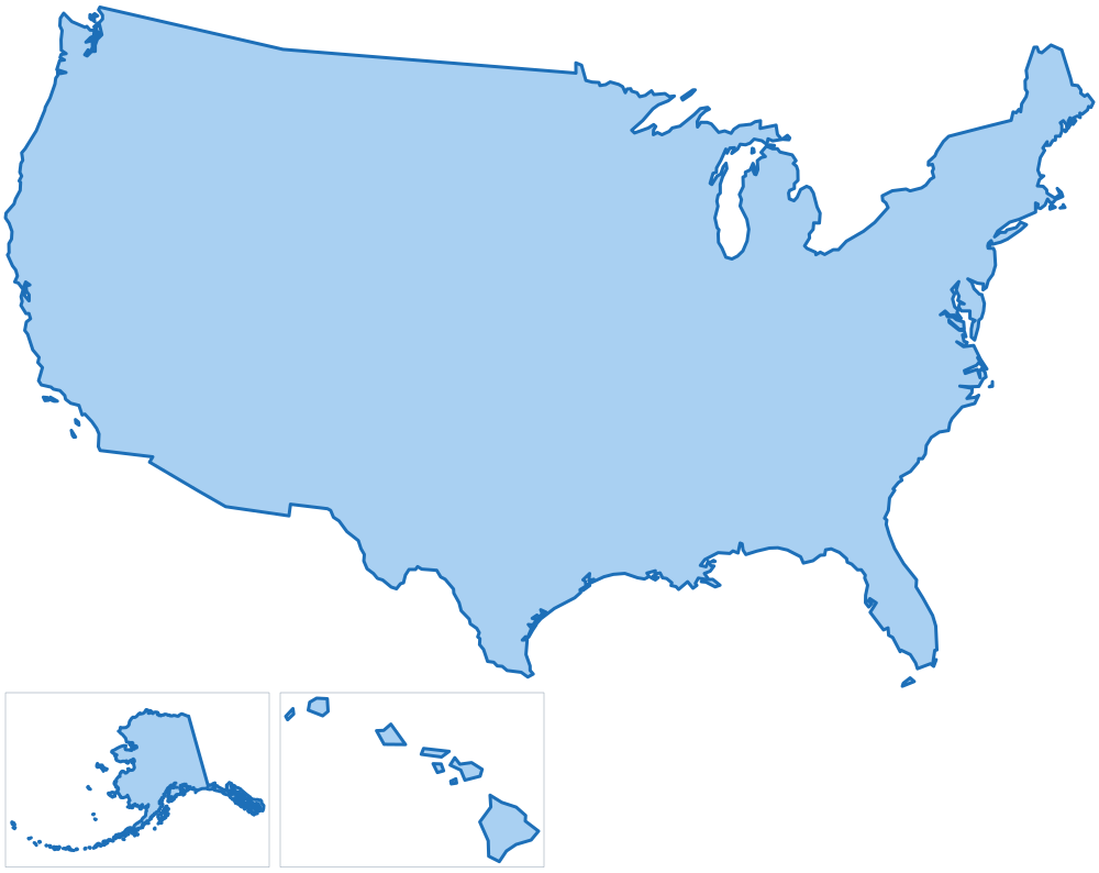
51 stati, 3.144 contee e 47.352 località, ogni ente con il suo codice ufficiale, in GeoJSON, TopoJSON, GeoPackage, Shapefile, SVG a livelli, CSV e SQL.
- stati
- 51
- contee
- 3.144
- località
- 47.352
- edizione
Uno degli esempi del pacchetto
Un SVG a livelli colorato da una tabella con poche righe di JavaScript semplice: ogni ente è un path il cui id è il suo codice ufficiale. La pagina mostra una parte del paese: i due livelli condividono gli stessi confini, quindi combaciano senza spazi vuoti. Il pacchetto contiene ogni ente di ogni livello.
California: le sue contee, colorate per superficie, tra gli stati vicini.
Cosa c'è nel pacchetto
Livelli e identificativi
| Livello | Enti | Identificativo |
|---|---|---|
| paese | 1 | US |
| stati | 51 | US-R-<codice ufficiale> |
| contee | 3.144 | US-P-<codice ufficiale> |
| località | 47.352 | US-M-<codice ufficiale> |
Ogni ente ha lo stesso identificativo in ogni file: è l'id della feature in GeoJSON e TopoJSON, l'id del path in SVG e la colonna id delle tabelle.
Formati e scale
| Formato | full | 100m | 1km | 10km | light |
|---|---|---|---|---|---|
| GeoJSON | 89,0 MB | 74,1 MB | 25,1 MB | 1,4 MB | 1,5 MB |
| TopoJSON | 37,2 MB | 33,1 MB | 17,9 MB | 1,0 MB | 1,3 MB |
| Shapefile | 68,5 MB | 57,0 MB | 19,7 MB | 1,1 MB | 1,2 MB |
| SVG | - | 68,4 MB | 22,2 MB | 1,2 MB | 1,4 MB |
full: i confini come li pubblica la fonte.100m: semplificati entro 100 m e coerenti: località, contee e stati condividono esattamente gli stessi vertici del confine.1km: semplificati entro 1 km e coerenti come100m, tutti i livelli: l'intero paese su una mappa web.10km: semplificati entro 10 km e coerenti, solo paese, stati e contee: mappe piccole e mappe di molti paesi.- Sulle frontiere con le nazioni confinanti (Messico) i confini
100m,1kme10kmhanno gli stessi vertici dei loro pacchetti, così le mappe combaciano senza spazi né sovrapposizioni. light: solo paese, stati e contee, ogni livello semplificato per conto suo in un file leggero.- GeoJSON: una FeatureCollection per livello, WGS84. TopoJSON: tutti i livelli in una sola topologia, i confini condivisi sono archi condivisi.
- GeoPackage:
data/geopackage/us.gpkg(194,6 MB), un solo file per QGIS e ArcGIS con ogni livello a ogni scala come layer (municipalities_100m) con il suo indice spaziale, e tutte le tabelle del pacchetto. - Shapefile: uno per livello e scala, WGS84, UTF-8; i nomi delle colonne più lunghi di dieci caratteri sono abbreviati (
region,province,abbrev). - SVG: un file per livello e uno con tutti i livelli come layer, in proiezione conica conforme di Lambert; si aprono a livelli in Illustrator, Figma e Inkscape.
- SQL: uno script per PostGIS, uno per MySQL 8 e uno per SQL Server (75,0 MB ciascuno). Crea una tabella con ogni ente di ogni livello, il suo confine
100min WGS84 e i suoi indici. - JSON:
data/json/tree.json(4,0 MB), i livelli annidati e ordinati per nome, senza confini: quello che serve ai menu a tendina di un modulo.
Tabelle
CSV, UTF-8. Nomi in EN, IT, ES, FR, DE, NL, PT, oltre a quello ufficiale.
| File | Righe | Contenuto |
|---|---|---|
tables/country.csv |
1 |
Il paese: nomi, popolazione, riquadro di delimitazione, centro e punto dell'etichetta.
code, name, population, min_lat, min_lng, max_lat, max_lng, center_lat, center_lng, label_lat, label_lng, id, name_en, name_it, name_es, name_fr, name_de, name_nl, name_pt
|
tables/regions.csv |
51 |
Una riga per ente (stati): codice ufficiale, nomi, superficie, popolazione, riquadro di delimitazione, centro e punto dell'etichetta.
code, name, area_km2, population, min_lat, min_lng, max_lat, max_lng, center_lat, center_lng, label_lat, label_lng, id, name_en, name_it, name_es, name_fr, name_de, name_nl, name_pt
|
tables/provinces.csv |
3.144 |
Una riga per ente (contee): codice ufficiale, sigla, codice dell'ente superiore, nomi, superficie, popolazione, riquadro di delimitazione, centro e punto dell'etichetta.
code, name, abbreviation, region_code, area_km2, population, min_lat, min_lng, max_lat, max_lng, center_lat, center_lng, label_lat, label_lng, id, name_en, name_it, name_es, name_fr, name_de, name_nl, name_pt
|
tables/municipalities.csv |
47.352 |
Una riga per ente (località): codice ufficiale, codici degli enti superiori, nomi, superficie, popolazione, altitudine in metri (del centro, oppure minima e massima, come la fornisce la fonte ufficiale), riquadro di delimitazione, centro e punto dell'etichetta.
code, name, province_code, province_abbreviation, region_code, cadastral_code, chief_town, area_km2, population, elevation, elevation_min, elevation_max, elevation_mean, min_lat, min_lng, max_lat, max_lng, center_lat, center_lng, label_lat, label_lng, id, name_en, name_it, name_es, name_fr, name_de, name_nl, name_pt
|
tables/codes.csv |
50.548 |
Ogni ente negli altri dataset, come lo dichiara Wikidata: l'elemento Wikidata, ISO 3166-2, GeoNames e la relazione OpenStreetMap.
id, level, code, wikidata, iso_3166_2, geonames, osm_relation
|
tables/names.csv |
61.777 |
Ogni nome con cui si scrive un ente (ufficiale, ciascuna parte di un nome bilingue, tradotto), senza accenti e come slug: per abbinare un file che ha i nomi e non i codici.
id, level, name, name_ascii, slug, kind
|
tables/neighbours.csv |
184.476 |
Gli enti dello stesso livello che confinano, in entrambe le direzioni, con la lunghezza del confine comune in km.
level, id, neighbour_id, shared_border_km
|
tables/history.csv |
0 |
Enti soppressi (località) con il successore, per gli archivi che riportano ancora i vecchi codici; nessuna riga dove la fonte ufficiale non fornisce lo storico.
code, name, province_code, replaced_by_code, replaced_by_name
|
tables/changes.csv |
0 |
Cosa è cambiato da un'edizione del pacchetto alla successiva, una riga per ogni ente aggiunto, rimosso, rinominato, spostato o con un nuovo confine: come in CHANGELOG.md.
edition, date, level, id, name, change, before, after
|
Fonti e licenze
Il pacchetto è un'opera derivata dai dataset ufficiali elencati qui sotto; i loro editori non lo avallano. Cosa puoi farne è scritto nella licenza dei pacchetti.
- U.S. Census Bureau, Gazetteer Files, Population Estimates, American Community Survey 5-year, ZCTA Relationship Files, con licenza Public domain (17 U.S.C. 105)
- U.S. Census Bureau, Cartographic Boundary Files 1:500,000, con licenza Public domain (17 U.S.C. 105)
- Wikidata, Labels and external identifiers of the administrative entities (translated names, codes in other datasets), con licenza CC0 1.0
File
Tutti i 198 file del pacchetto, con la loro dimensione.
ATTRIBUTION.md | 6 KB |
|---|---|
CHANGELOG.md | 0 KB |
LICENSE.md | 2 KB |
README.md | 15 KB |
data/geojson/100m/country.geojson | 3,1 MB |
data/geojson/100m/municipalities.geojson | 50,6 MB |
data/geojson/100m/provinces.geojson | 16,1 MB |
data/geojson/100m/regions.geojson | 4,3 MB |
data/geojson/10km/country.geojson | 45 KB |
data/geojson/10km/provinces.geojson | 1,2 MB |
data/geojson/10km/regions.geojson | 112 KB |
data/geojson/1km/country.geojson | 517 KB |
data/geojson/1km/municipalities.geojson | 20,6 MB |
data/geojson/1km/provinces.geojson | 3,2 MB |
data/geojson/1km/regions.geojson | 767 KB |
data/geojson/full/municipalities.geojson | 62,3 MB |
data/geojson/full/provinces.geojson | 21,1 MB |
data/geojson/full/regions.geojson | 5,7 MB |
data/geojson/light/country.geojson | 42 KB |
data/geojson/light/provinces.geojson | 1,3 MB |
data/geojson/light/regions.geojson | 218 KB |
data/geopackage/us.gpkg | 194,6 MB |
data/json/tree.json | 4,0 MB |
data/shapefile/100m/country.cpg | 0 KB |
data/shapefile/100m/country.dbf | 0 KB |
data/shapefile/100m/country.prj | 0 KB |
data/shapefile/100m/country.shp | 2,3 MB |
data/shapefile/100m/country.shx | 0 KB |
data/shapefile/100m/municipalities.cpg | 0 KB |
data/shapefile/100m/municipalities.dbf | 5,7 MB |
data/shapefile/100m/municipalities.prj | 0 KB |
data/shapefile/100m/municipalities.shp | 33,2 MB |
data/shapefile/100m/municipalities.shx | 370 KB |
data/shapefile/100m/provinces.cpg | 0 KB |
data/shapefile/100m/provinces.dbf | 366 KB |
data/shapefile/100m/provinces.prj | 0 KB |
data/shapefile/100m/provinces.shp | 11,9 MB |
data/shapefile/100m/provinces.shx | 25 KB |
data/shapefile/100m/regions.cpg | 0 KB |
data/shapefile/100m/regions.dbf | 3 KB |
data/shapefile/100m/regions.prj | 0 KB |
data/shapefile/100m/regions.shp | 3,2 MB |
data/shapefile/100m/regions.shx | 0 KB |
data/shapefile/10km/country.cpg | 0 KB |
data/shapefile/10km/country.dbf | 0 KB |
data/shapefile/10km/country.prj | 0 KB |
data/shapefile/10km/country.shp | 34 KB |
data/shapefile/10km/country.shx | 0 KB |
data/shapefile/10km/provinces.cpg | 0 KB |
data/shapefile/10km/provinces.dbf | 366 KB |
data/shapefile/10km/provinces.prj | 0 KB |
data/shapefile/10km/provinces.shp | 607 KB |
data/shapefile/10km/provinces.shx | 25 KB |
data/shapefile/10km/regions.cpg | 0 KB |
data/shapefile/10km/regions.dbf | 3 KB |
data/shapefile/10km/regions.prj | 0 KB |
data/shapefile/10km/regions.shp | 81 KB |
data/shapefile/10km/regions.shx | 0 KB |
data/shapefile/1km/country.cpg | 0 KB |
data/shapefile/1km/country.dbf | 0 KB |
data/shapefile/1km/country.prj | 0 KB |
data/shapefile/1km/country.shp | 386 KB |
data/shapefile/1km/country.shx | 0 KB |
data/shapefile/1km/municipalities.cpg | 0 KB |
data/shapefile/1km/municipalities.dbf | 5,7 MB |
data/shapefile/1km/municipalities.prj | 0 KB |
data/shapefile/1km/municipalities.shp | 10,3 MB |
data/shapefile/1km/municipalities.shx | 370 KB |
data/shapefile/1km/provinces.cpg | 0 KB |
data/shapefile/1km/provinces.dbf | 366 KB |
data/shapefile/1km/provinces.prj | 0 KB |
data/shapefile/1km/provinces.shp | 2,1 MB |
data/shapefile/1km/provinces.shx | 25 KB |
data/shapefile/1km/regions.cpg | 0 KB |
data/shapefile/1km/regions.dbf | 3 KB |
data/shapefile/1km/regions.prj | 0 KB |
data/shapefile/1km/regions.shp | 574 KB |
data/shapefile/1km/regions.shx | 0 KB |
data/shapefile/full/municipalities.cpg | 0 KB |
data/shapefile/full/municipalities.dbf | 5,7 MB |
data/shapefile/full/municipalities.prj | 0 KB |
data/shapefile/full/municipalities.shp | 42,1 MB |
data/shapefile/full/municipalities.shx | 370 KB |
data/shapefile/full/provinces.cpg | 0 KB |
data/shapefile/full/provinces.dbf | 366 KB |
data/shapefile/full/provinces.prj | 0 KB |
data/shapefile/full/provinces.shp | 15,6 MB |
data/shapefile/full/provinces.shx | 25 KB |
data/shapefile/full/regions.cpg | 0 KB |
data/shapefile/full/regions.dbf | 3 KB |
data/shapefile/full/regions.prj | 0 KB |
data/shapefile/full/regions.shp | 4,3 MB |
data/shapefile/full/regions.shx | 0 KB |
data/shapefile/light/country.cpg | 0 KB |
data/shapefile/light/country.dbf | 0 KB |
data/shapefile/light/country.prj | 0 KB |
data/shapefile/light/country.shp | 32 KB |
data/shapefile/light/country.shx | 0 KB |
data/shapefile/light/provinces.cpg | 0 KB |
data/shapefile/light/provinces.dbf | 366 KB |
data/shapefile/light/provinces.prj | 0 KB |
data/shapefile/light/provinces.shp | 642 KB |
data/shapefile/light/provinces.shx | 25 KB |
data/shapefile/light/regions.cpg | 0 KB |
data/shapefile/light/regions.dbf | 3 KB |
data/shapefile/light/regions.prj | 0 KB |
data/shapefile/light/regions.shp | 160 KB |
data/shapefile/light/regions.shx | 0 KB |
data/topojson/100m/us.topojson | 33,1 MB |
data/topojson/10km/us.topojson | 1,0 MB |
data/topojson/1km/us.topojson | 17,9 MB |
data/topojson/full/us.topojson | 37,2 MB |
data/topojson/light/us.topojson | 1,3 MB |
examples/choropleth-svg.html | 8,0 MB |
examples/drill-down-d3.html | 5,5 MB |
examples/leaflet-geojson.html | 1,3 MB |
examples/lib/LICENSES.md | 3 KB |
examples/lib/d3.min.js | 273 KB |
examples/lib/leaflet.css | 14 KB |
examples/lib/leaflet.js | 144 KB |
examples/lib/topojson-client.min.js | 7 KB |
examples/point-lookup.html | 16,9 MB |
flags/US-R-01.svg | 0 KB |
flags/US-R-02.svg | 1 KB |
flags/US-R-04.svg | 0 KB |
flags/US-R-05.svg | 12 KB |
flags/US-R-06.svg | 162 KB |
flags/US-R-08.svg | 1 KB |
flags/US-R-09.svg | 282 KB |
flags/US-R-10.svg | 196 KB |
flags/US-R-11.svg | 1 KB |
flags/US-R-12.svg | 600 KB |
flags/US-R-13.svg | 46 KB |
flags/US-R-15.svg | 1 KB |
flags/US-R-16.svg | 798 KB |
flags/US-R-17.svg | 104 KB |
flags/US-R-18.svg | 6 KB |
flags/US-R-19.svg | 166 KB |
flags/US-R-20.svg | 221 KB |
flags/US-R-21.svg | 237 KB |
flags/US-R-22.svg | 1,5 MB |
flags/US-R-23.svg | 432 KB |
flags/US-R-24.svg | 1 KB |
flags/US-R-25.svg | 202 KB |
flags/US-R-26.svg | 126 KB |
flags/US-R-27.svg | 197 KB |
flags/US-R-29.svg | 313 KB |
flags/US-R-30.svg | 193 KB |
flags/US-R-31.svg | 330 KB |
flags/US-R-32.svg | 281 KB |
flags/US-R-33.svg | 131 KB |
flags/US-R-34.svg | 209 KB |
flags/US-R-35.svg | 0 KB |
flags/US-R-36.svg | 137 KB |
flags/US-R-37.svg | 22 KB |
flags/US-R-38.svg | 323 KB |
flags/US-R-39.svg | 2 KB |
flags/US-R-40.svg | 130 KB |
flags/US-R-41.svg | 69 KB |
flags/US-R-42.svg | 757 KB |
flags/US-R-44.svg | 7 KB |
flags/US-R-45.svg | 42 KB |
flags/US-R-47.svg | 1 KB |
flags/US-R-48.svg | 1 KB |
flags/US-R-49.svg | 220 KB |
flags/US-R-50.svg | 559 KB |
flags/US-R-51.svg | 238 KB |
flags/US-R-53.svg | 251 KB |
flags/US-R-54.svg | 176 KB |
flags/US-R-55.svg | 397 KB |
flags/US-R-56.svg | 68 KB |
flags/US.svg | 1 KB |
sql/mysql.sql | 76,1 MB |
sql/postgis.sql | 75,0 MB |
sql/sqlserver.sql | 76,2 MB |
svg/100m/layers.svg | 34,9 MB |
svg/100m/municipalities.svg | 23,5 MB |
svg/100m/provinces.svg | 7,9 MB |
svg/100m/regions.svg | 2,0 MB |
svg/10km/layers.svg | 642 KB |
svg/10km/provinces.svg | 565 KB |
svg/10km/regions.svg | 56 KB |
svg/1km/layers.svg | 11,2 MB |
svg/1km/municipalities.svg | 9,1 MB |
svg/1km/provinces.svg | 1,5 MB |
svg/1km/regions.svg | 381 KB |
svg/light/layers.svg | 716 KB |
svg/light/provinces.svg | 588 KB |
svg/light/regions.svg | 108 KB |
tables/changes.csv | 0 KB |
tables/codes.csv | 2,6 MB |
tables/country.csv | 0 KB |
tables/history.csv | 0 KB |
tables/municipalities.csv | 9,3 MB |
tables/names.csv | 4,1 MB |
tables/neighbours.csv | 8,0 MB |
tables/provinces.csv | 742 KB |
tables/regions.csv | 9 KB |
Il pacchetto Stati Uniti non è ancora in vendita. Puoi provarlo subito: ricevi il campione gratuito, Delaware (3 contee e 79 località), con gli stessi file e formati.