
 EN
 Italiano
 Español
 Français
 Deutsch
 Nederlands
 Português
 Slovenščina
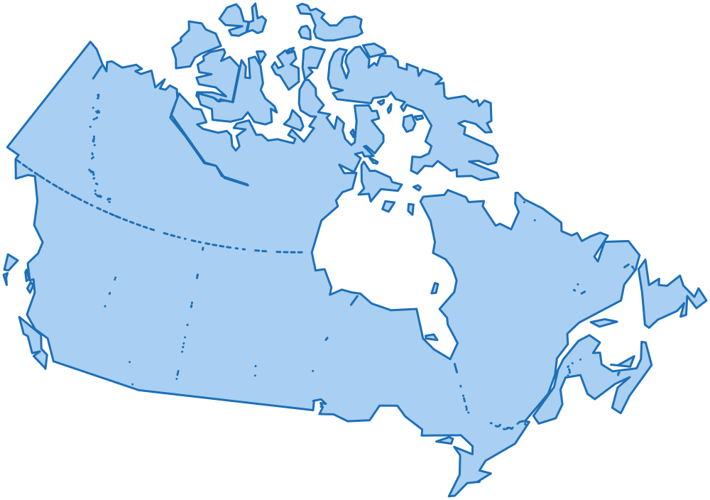
 Canada administrative boundaries
, each with its official code, in GeoJSON, TopoJSON, GeoPackage, Shapefile, layered SVG, CSV and SQL.
- edition
What is in the package
Levels and identifiers
| Level | Entities | Identifier |
|---|---|---|
| country | 1 | CA |
Every entity has the same identifier in every file: it is the feature id in GeoJSON and TopoJSON, the id of the path in SVG and the id column of the tables.
Formats and scales
| Format | full | 100m | 1km | 10km | light |
|---|---|---|---|---|---|
| GeoJSON | - | - | - | - | - |
| TopoJSON | - | - | - | - | - |
| Shapefile | - | - | - | - | - |
| SVG | - | - | - | - | - |
full: the boundaries as published by the source.100m: simplified within 100 m and coherent: share exactly the same border vertices.1km: simplified within 1 km and coherent like100m, every level: the whole country on a web map.10km: simplified within 10 km and coherent, country only: small maps and maps of many countries.- At the borders with the neighbouring countries (United States) the
100m,1kmand10kmboundaries share the same vertices as in their packages, so the maps fit without gaps or overlaps. light: country only, each level simplified on its own to a small file.- GeoJSON: one FeatureCollection per level, WGS84. TopoJSON: all the levels in one topology, shared borders are shared arcs.
- SVG: one file per level and one with every level as a layer, in a Lambert conformal conic projection; they open as layers in Illustrator, Figma and Inkscape.
- JSON:
data/json/tree.json(0 KB), the levels nested and sorted by name, without boundaries: what the select boxes of a form need.
Tables
CSV, UTF-8. Names in EN, IT, ES, FR, DE, NL, PT, besides the official one.
| File | Rows | Content |
|---|---|---|
tables/country.csv |
1 |
The country: names, population, bounding box, centre and label point.
code, name, population, min_lat, min_lng, max_lat, max_lng, center_lat, center_lng, label_lat, label_lng, id, name_en, name_it, name_es, name_fr, name_de, name_nl, name_pt
|
tables/provinces.csv |
0 |
The census divisions: official code, abbreviation, the code of the parent, names, area, population, bounding box, centre and label point.
code, name, abbreviation, region_code, area_km2, population, min_lat, min_lng, max_lat, max_lng, center_lat, center_lng, label_lat, label_lng, id, name_en, name_it, name_es, name_fr, name_de, name_nl, name_pt
|
tables/municipalities.csv |
0 |
The census subdivisions: official code, the codes of the parents, names, area, population, elevation in metres (of the centre, or lowest and highest point, as the official source gives it), bounding box, centre and label point.
code, name, province_code, province_abbreviation, region_code, cadastral_code, chief_town, area_km2, population, elevation, elevation_min, elevation_max, elevation_mean, min_lat, min_lng, max_lat, max_lng, center_lat, center_lng, label_lat, label_lng, id, name_en, name_it, name_es, name_fr, name_de, name_nl, name_pt
|
tables/names.csv |
1 |
Every name an entity is written with (official, each side of a bilingual name, translated), without accents and as a slug: to match a file that has names and no codes.
id, level, name, name_ascii, slug, kind
|
tables/neighbours.csv |
0 |
The entities of the same level that share a border, both ways, with the length of the shared border in km.
level, id, neighbour_id, shared_border_km
|
tables/history.csv |
0 |
The suppressed census subdivisions with the one that replaced them, for archives that still have the old codes; no rows where the official source gives no history.
code, name, province_code, replaced_by_code, replaced_by_name
|
tables/changes.csv |
0 |
What changed from one edition of the package to the next, one row per entity added, removed, renamed, moved or with a new boundary: the same as CHANGELOG.md.
edition, date, level, id, name, change, before, after
|
Sources and licenses
The package is a derived work of the official datasets below; their publishers do not endorse it. What you may do with it is in the license of the packages.
- Statistics Canada, Census Subdivision Boundary File (92-162-X); 2021 Census Cartographic Boundary Files (92-160-X), licensed Statistics Canada Open Licence
- Statistics Canada, Census Subdivision Boundary File (92-162-X); 2021 Census Cartographic Boundary Files (92-160-X), licensed Statistics Canada Open Licence
Files
All the 13 files of the package, with their size.
ATTRIBUTION.md | 2 KB |
|---|---|
CHANGELOG.md | 0 KB |
LICENSE.md | 2 KB |
README.md | 7 KB |
data/json/tree.json | 0 KB |
flags/CA.svg | 1 KB |
tables/changes.csv | 0 KB |
tables/country.csv | 0 KB |
tables/history.csv | 0 KB |
tables/municipalities.csv | 0 KB |
tables/names.csv | 0 KB |
tables/neighbours.csv | 0 KB |
tables/provinces.csv | 0 KB |
The package of Canada is not on sale yet.